Here are two examples of geographic data visualization using Tableau, a powerful tool for data analysis and visualization. The data used for these examples is sourced from Data Commons. The visualizations are simple, yet they effectively demonstrate the potential of Tableau's mapping capabilities.
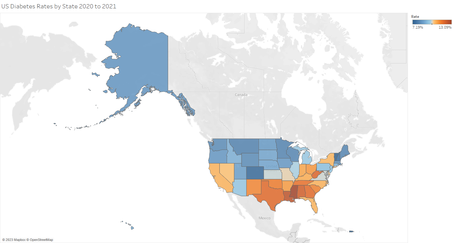
Visualizing US Diabetes Rates by State from 2020 to 2021
The first visualization is a map of the United States, color-coded to represent the rates of diabetes in each state for the years 2020 and 2021. This map provides a quick and clear overview of the geographical distribution of diabetes rates across the country.
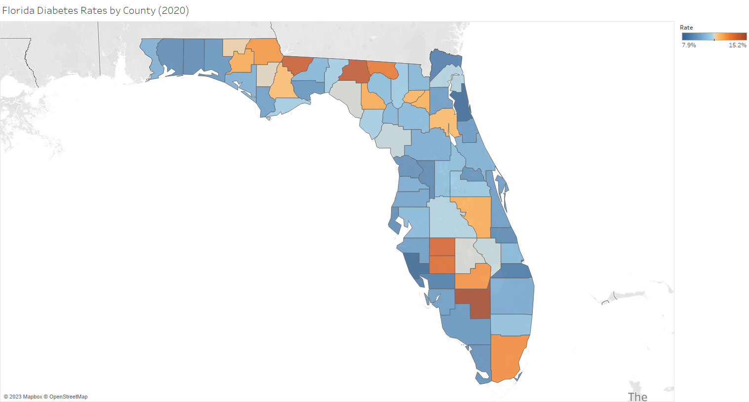
Visualizing Florida Diabetes Rates by County (2020)
The second visualization focuses on the state of Florida, with each county color-coded according to its diabetes rate. This map offers a more detailed view of the diabetes situation within a specific state.
In both maps, tooltips are used to display the data for each state or county. This approach keeps the maps uncluttered and easy to read, while still providing detailed information on demand.
These examples illustrate the power and flexibility of Tableau's mapping capabilities. With Tableau, you can quickly create clear, informative, and visually appealing maps to enhance your data analysis and presentations.
Click on a map to see the visualization at Tableau Public.